Distance between Molave and Busuanga
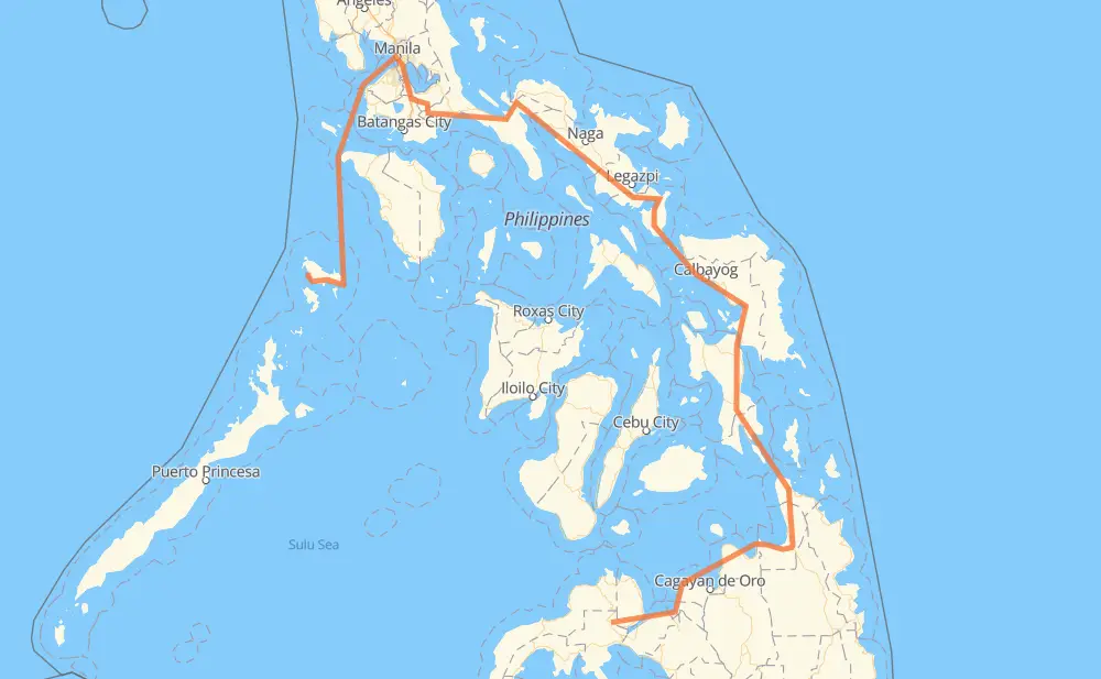
The distance from Molave to Busuanga is 1,219 miles by road including 32 miles on motorways. Road takes approximately 40 hours and 47 minutes and goes through Tangub, Ozamiz, Iligan, El Salvador, Gingoog, Butuan and Surigao City.
| Shortest distance by air | 369 mi ✈️ |
| Car route length | 1,218.5 mi 🚗 |
| Driving time | 40 h 47 min |
| Fuel amount | 41.4 gal |
| Fuel cost | 162.9 USD |
| Point | Distance | Time | Fuel | |
| Molave | 0 mi | 00 min | 0.0 gal | |
|
78 22 mi, 25 min
|
||||
| Tangub | 22 mi | 25 min | 0.7 gal | |
|
78 9 mi, 11 min
|
||||
| Ozamiz | 31 mi | 36 min | 1.0 gal | |
|
78 9 37 mi, 1 h 06 min
|
||||
| Iligan | 68 mi | 1 h 43 min | 2.3 gal | |
|
9 45 mi, 1 h 13 min
|
||||
| El Salvador | 113 mi | 2 h 56 min | 3.7 gal | |
|
9 955 71 mi, 1 h 32 min
|
||||
| Gingoog | 183 mi | 4 h 29 min | 6.1 gal | |
|
9 45 mi, 1 h 12 min
|
||||
| Butuan | 229 mi | 5 h 41 min | 7.7 gal | |
|
9 AH26 75 mi, 1 h 36 min
|
||||
| Surigao City | 303 mi | 7 h 17 min | 10.3 gal | |
|
1 142 mi, 3 h 50 min
|
||||
| Tacloban | 445 mi | 11 h 08 min | 15.1 gal | |
|
1 62 mi, 1 h 22 min
|
||||
| Catbalogan | 508 mi | 12 h 31 min | 17.0 gal | |
|
1 52 mi, 1 h 15 min
|
||||
| Calbayog | 559 mi | 13 h 46 min | 18.5 gal | |
|
1 90 mi, 2 h 43 min
|
||||
| Sorsogon City | 649 mi | 16 h 30 min | 22.0 gal | |
|
1 50 mi, 1 h 00 min
|
||||
| Ligao | 700 mi | 17 h 30 min | 23.7 gal | |
|
1 38 mi, 51 min
|
||||
| Naga | 738 mi | 18 h 22 min | 25.0 gal | |
|
1 187 mi, 3 h 55 min
|
||||
| San Pablo | 925 mi | 22 h 17 min | 31.3 gal | |
|
1 AH26 21 mi, 25 min
|
||||
| Calamba | 946 mi | 22 h 43 min | 32.0 gal | |
|
E2 4 mi, 03 min
|
||||
| Cabuyao | 949 mi | 22 h 47 min | 32.3 gal | |
|
E2 2 mi, 01 min
|
||||
| Santa Rosa | 952 mi | 22 h 49 min | 32.3 gal | |
|
E2 4 mi, 03 min
|
||||
| Biñan | 956 mi | 22 h 53 min | 32.4 gal | |
|
E2 3 mi, 03 min
|
||||
| San Pedro | 959 mi | 22 h 56 min | 32.6 gal | |
|
E2 262 mi, 17 h 50 min
|
||||
| Busuanga | 1,221 mi | 40 h 47 min | 41.1 gal | |
Hotels of Busuanga
Frequently Asked Questions
How much does it cost to drive from Molave to Busuanga?
Fuel cost: 162.9 USD
This fuel cost is calculated as: (Route length 1,218.5 mi) / (Fuel consumption 29.4 mpg) * (Fuel price 3.93 USD / gal)
You can adjust fuel consumption and fuel price here.
How long is a car ride from Molave to Busuanga?
Driving time: 40 h 47 min
This time is calculated for driving at the maximum permitted speed, taking into account traffic rules restrictions.
- 28 mi with a maximum speed 62 mph = 27 min
- 116 mi with a maximum speed 56 mph = 2 h 4 min
- 3 mi with a maximum speed 56 mph = 3 min
- 557 mi with a maximum speed 50 mph = 11 h 12 min
- 12 mi with a maximum speed 43 mph = 16 min
- 226 mi with a maximum speed 37 mph = 6 h 3 min
- 29 mi with a maximum speed 31 mph = 56 min
- 8 mi with a maximum speed 25 mph = 18 min
- 2 mi with a maximum speed 19 mph = 6 min
- 240 mi with a maximum speed 12 mph = 19 h 18 min
The calculated driving time does not take into account intermediate stops and traffic jams.
How far is Molave to Busuanga by land?
The distance between Molave and Busuanga is 1,218.5 mi by road including 32.3 mi on motorways.
Precise satellite coordinates of highways were used for this calculation. The start and finish points are the centers of Molave and Busuanga respectively.
How far is Molave to Busuanga by plane?
The shortest distance (air line, as the crow flies) between Molave and Busuanga is 369.1 mi.
This distance is calculated using the Haversine formula as a great-circle distance between two points on the surface of a sphere. The start and finish points are the centers of Molave and Busuanga respectively. Actual distance between airports may be different.
How many hours is Molave from Busuanga by plane?
Boeing 737 airliner needs 44 min to cover the distance of 369 mi at a cruising speed of 497 mph.
Small plane "Cessna 172" needs 2 h 42 min to flight this distance at average speed of 136 mph.
This time is approximate and do not take into account takeoff and landing times, airport location and other real world factors.
How long is a helicopter ride from Molave to Busuanga?
Fast helicopter "Eurocopter AS350" or "Hughes OH-6 Cayuse" need 2 h 28 min to cover the distance of 369 mi at a cruising speed of 149 mph.
Popular "Robinson R44" needs 2 h 49 min to flight this distance at average speed of 130 mph.
This time is approximate and do not take into account takeoff and landing times, aerodrome location and other real world factors.
What city is halfway between Molave and Busuanga?
The halfway point between Molave and Busuanga is Laboy Site. It is located about 5 mi from the exact midpoint by road.
The distance from Laboy Site to Molave is 615 mi and driving will take about 15 h 44 min. The road between Laboy Site and Busuanga has length 604 mi and will take approximately 25 h 2 min.
The other cities located close to halfway point:
Where is Molave in relation to Busuanga?
Molave is located 369 mi south-east of Busuanga.
Molave has geographic coordinates: latitude 8.09277, longitude 123.48492.
Busuanga has geographic coordinates: latitude 12.13321, longitude 119.93614.
Which highway goes from Molave to Busuanga?
The route from Molave to Busuanga follows AH26, 1, 9.
Other minor sections pass along the road:
- 68: 58 mi
- 955: 43 mi
- E2: 32 mi
- 78: 30 mi
- 691: 24 mi
- 609: 5 mi
- 120: 3 mi
- 673: 2 mi
- 608: 2 mi
- 190: 1 mi
- 80: 1 mi